All
Airport
Maps
Aéroports
Pays
Rechercher
English
Español
Português
Français
Bahasa Indonesia
Deutsch
Русский
简体中文
繁體中文
हिन्दी
বাংলা
日本語
Kiswahili
Türkçe
Tiếng Việt
한국어
Italiano
ไทย
Polski
Українська
Română
Nederlands
Svenska
Čeština
Accueil
Aéroports
États-Unis
PHL Aéroport international de Philadelphie
Plan de l'Aéroport PHL - Guide du Terminal Aéroport international de Philadelphie
Aéroport de Philadelphie, États-Unis - Informations de Navigation dans le Terminal
Télécharger le Plan de l'Aéroport PHL
Télécharger le Plan du Terminal PHL en PDF
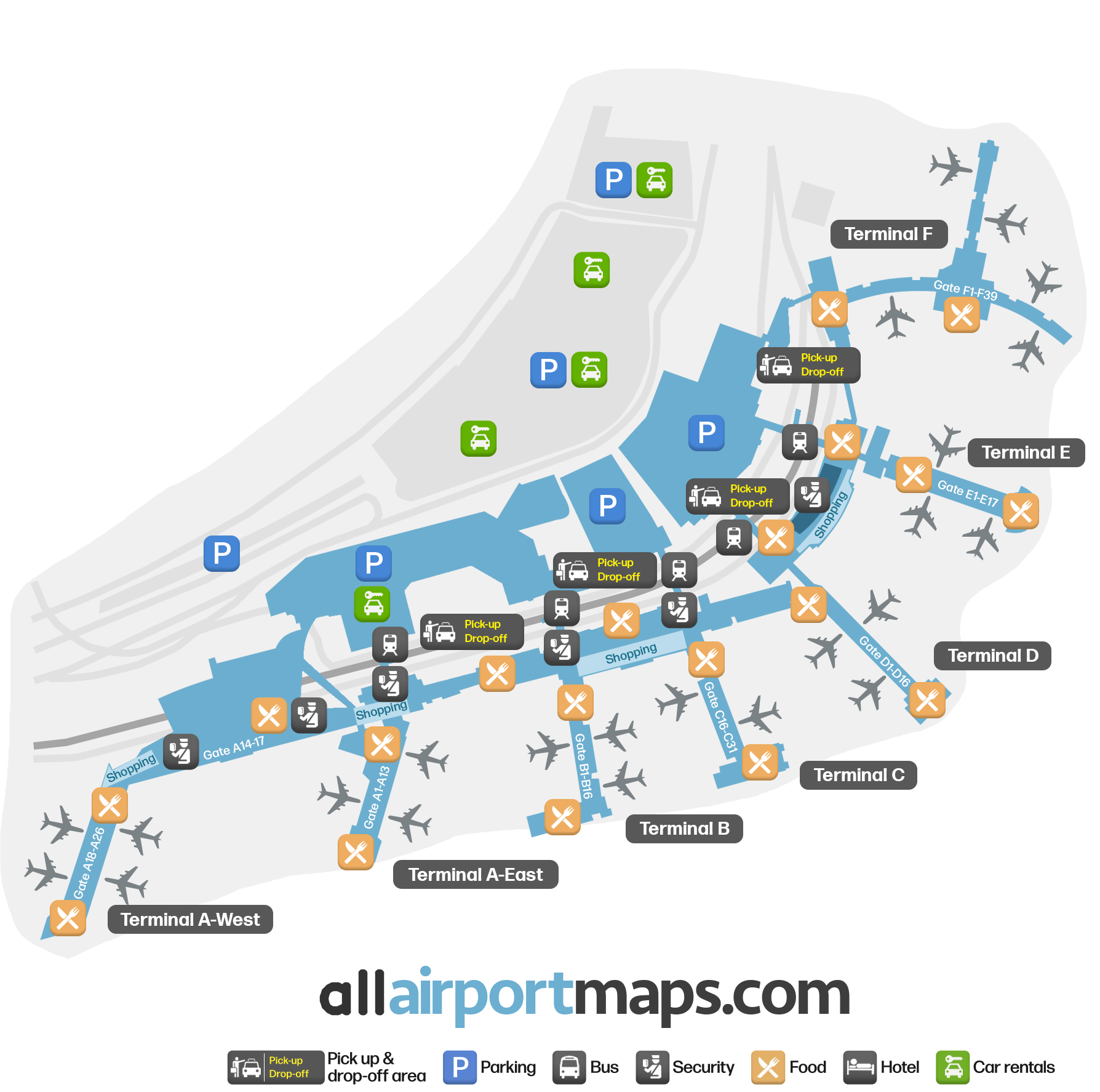
Plan du Terminal de l'Aéroport PHL - Portes & Navigation
Informations sur l'Heure de l'Aéroport - Heure Actuelle PHL
Heure Actuelle à l'Aéroport PHL
America/New_York
--:--
Votre Heure Locale
Votre Emplacement
--:--
Informations & Détails sur l'Aéroport Aéroport international de Philadelphie
Code IATA de l'Aéroport :
PHL
Emplacement de l'Aéroport :
Aéroport de Philadelphie, États-Unis
Coordonnées :
39.876413, -75.243305
Fuseau horaire :
America/New_York
Plans des Terminaux de PHL
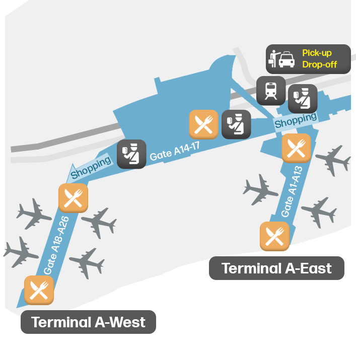
Plan du Terminal A - Plan PHL
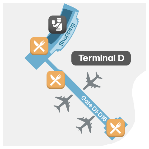
Plan du Terminal D - Plan PHL
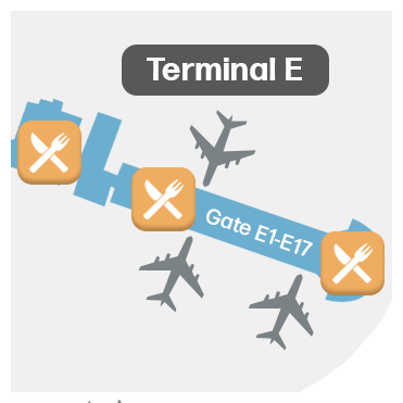
Plan du Terminal E - Plan PHL
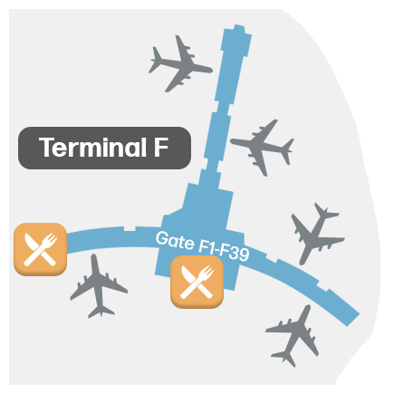
Plan du Terminal F - Plan PHL
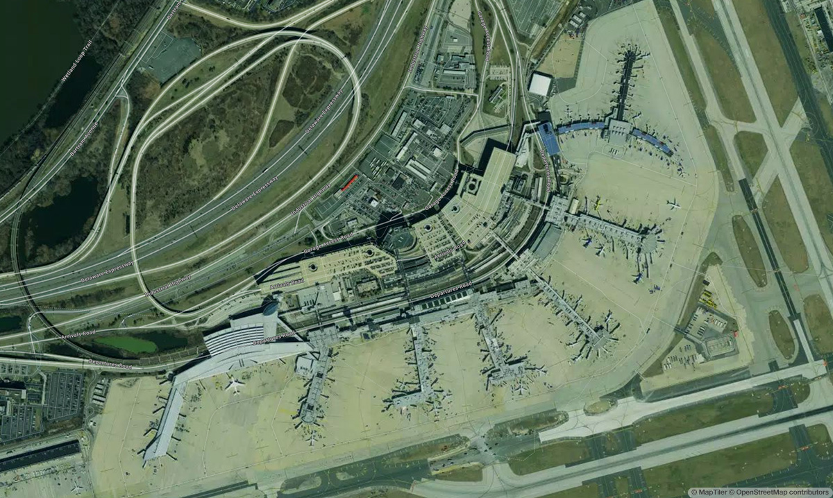
Vue Satellite de Aéroport international de Philadelphie & Plan Aérien
Carte Interactive - Emplacement de l'Aéroport PHL
Cartes externes - Voir l'aéroport PHL sur Google Maps et plus
Google Maps
Bing Maps
OpenStreetMap
Google Street View
↑