All
Airport
Maps
Luchthavens
Landen
Zoeken
English
Español
Português
Français
Bahasa Indonesia
Deutsch
Русский
简体中文
繁體中文
हिन्दी
বাংলা
日本語
Kiswahili
Türkçe
Tiếng Việt
한국어
Italiano
ไทย
Polski
Українська
Română
Nederlands
Svenska
Čeština
Home
Luchthavens
Koeweit
KWI Internationale Luchthaven Koeweit
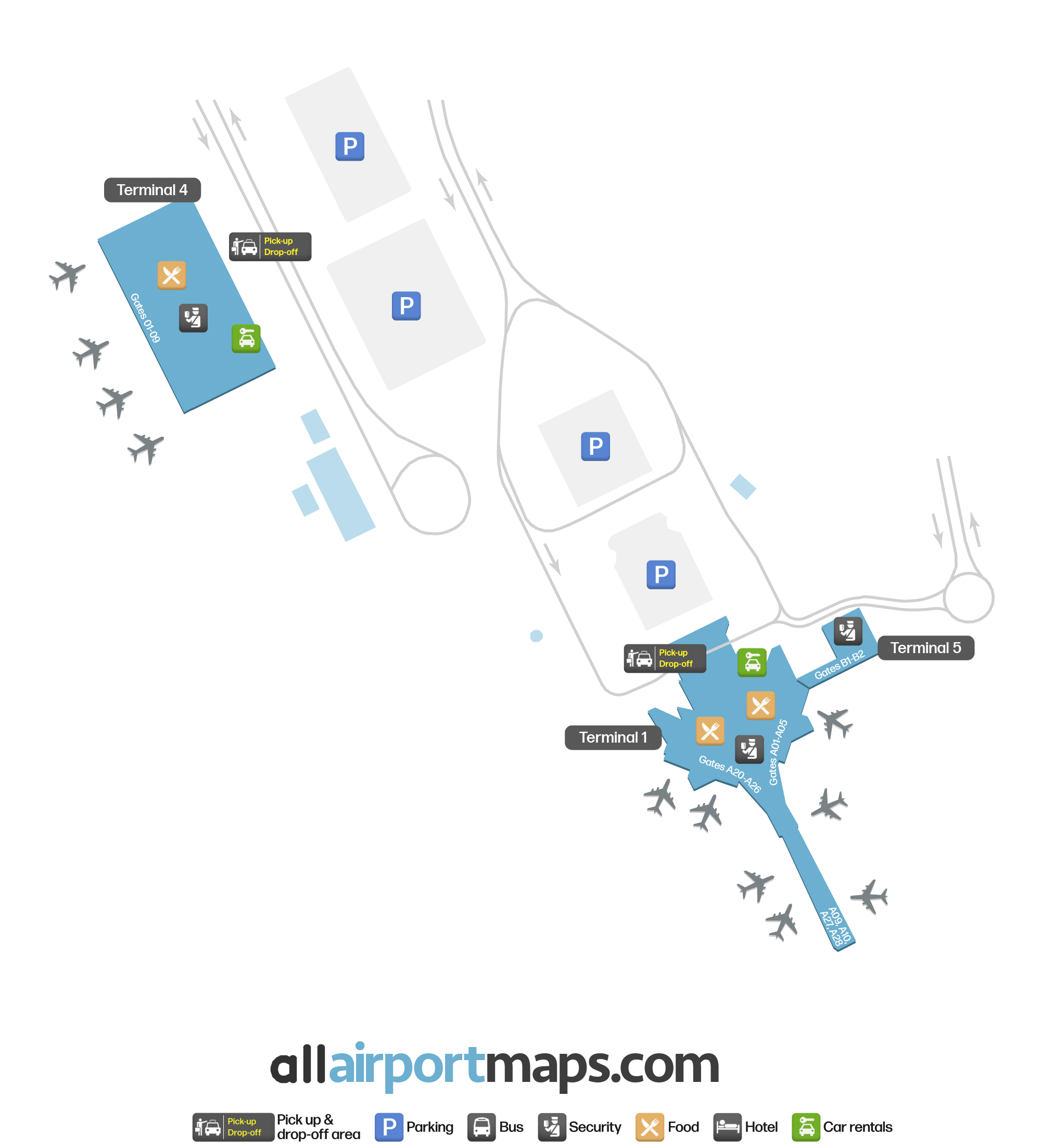
KWI Luchthavenkaart - Internationale Luchthaven Koeweit Terminalgids
Koeweit Luchthaven, Koeweit - Terminal Navigatie-informatie
Download KWI Luchthavenkaart
Download KWI Terminalkaart PDF
KWI Luchthaventerminalkaart - Gates & Navigatie
Luchthaven Tijdinformatie - KWI Huidige Tijd
KWI Luchthaven Huidige Tijd
Asia/Kuwait
--:--
Uw Lokale Tijd
Uw Locatie
--:--
Internationale Luchthaven Koeweit Luchthaveninfo & Details
Luchthaven IATA-code:
KWI
Luchthavenlocatie:
Koeweit Luchthaven, Koeweit
Coördinaten:
29.240116, 47.971251
Tijdzone:
Asia/Kuwait
KWI Terminalkaarten & Plattegronden
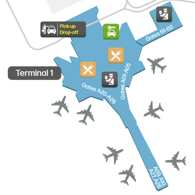
Terminal 1 Kaart - KWI Indeling
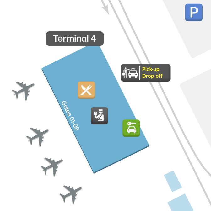
Terminal 4 Kaart - KWI Indeling
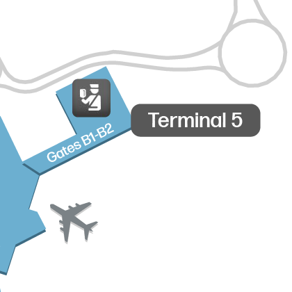
Terminal 5 Kaart - KWI Indeling
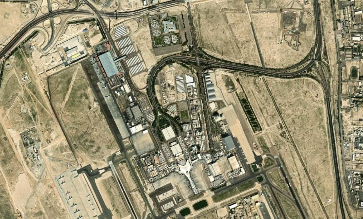
Internationale Luchthaven Koeweit Satellietbeeld & Luchtfoto
Interactieve Kaart - KWI Luchthavenlocatie
Externe kaarten - Bekijk luchthaven KWI op Google Maps en meer
Google Maps
Bing Maps
OpenStreetMap
Google Street View
↑