BFS Airport Map - Aldergrove Airport Terminal Guide

Belfast Airport, United Kingdom - Terminal Navigation Information

BFS Airport Terminal Map - Gates & Navigation

Aldergrove Airport Airport Terminal Map - BFS Gates, Airlines & Navigation Guide

Aldergrove Airport: Terminal and gate map

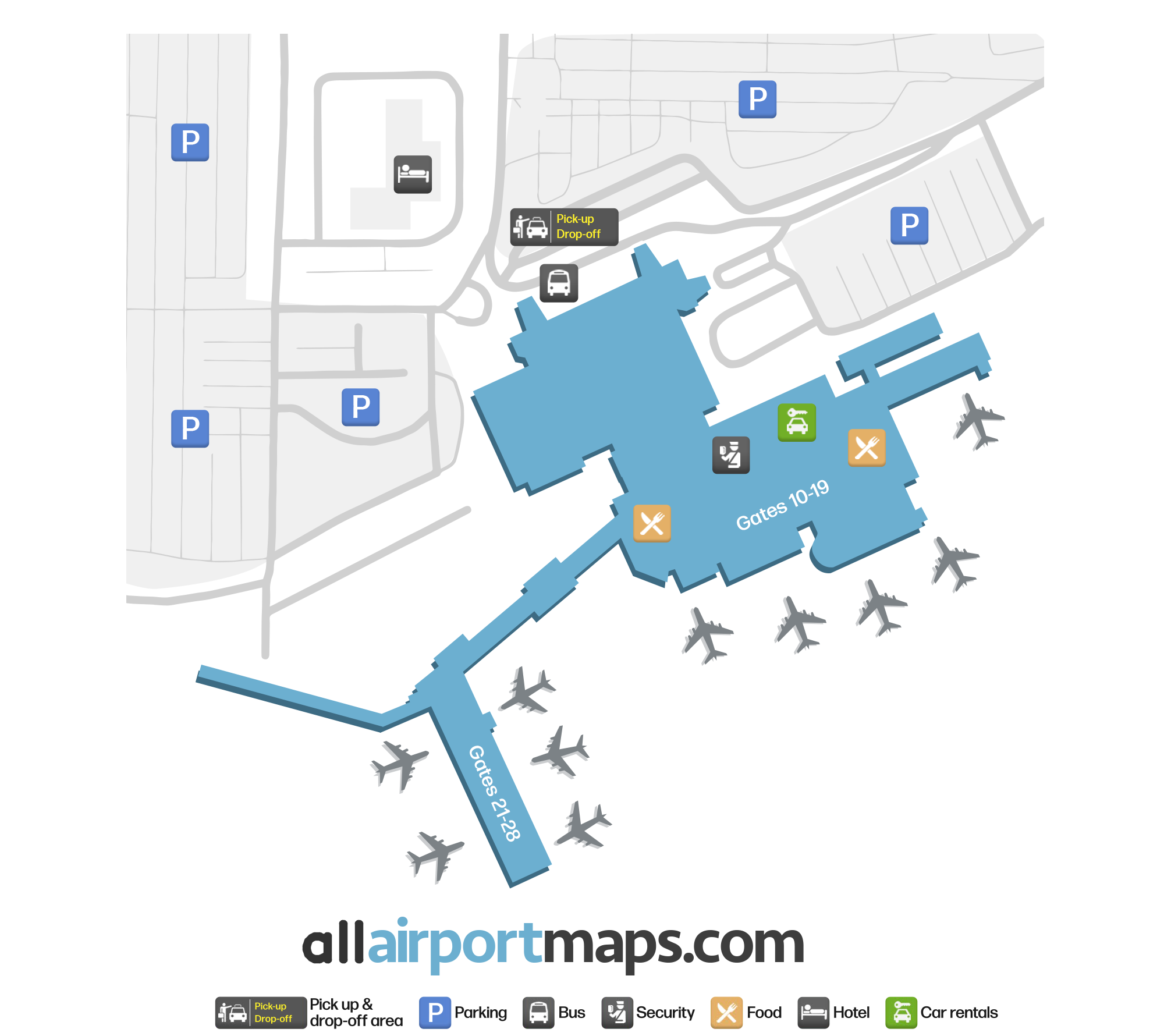
The airport consists of a single terminal building. There are several gates (10-19) located in the main area inside the security checkpoint. Heading to the right (west) from the entrance, there is a long hallway and several more gates (21-28) in a pier-shape formation.

Use our map at the top of this page to view the terminal layout, the location of the gates, shops and lounges, and the pick-up and drop-off area for the airport.

Airport Time Information - BFS Current Time

BFS Airport Current Time
Europe/London
--:--
Your Local Time
Your Location
--:--

Aldergrove Airport Airport Information & Details

Airport IATA Code: BFS
Airport Location: Belfast Airport, United Kingdom
Coordinates: 54.662397, -6.217616
Timezone: Europe/London

Aldergrove Airport Satellite View & Aerial Map

Aldergrove Airport Airport Satellite View - BFS Aerial Map & Terminal Overview

Interactive Map - BFS Airport Location

External Maps - View BFS Airport on Google Maps & More