CGK Airport Map - Soekarno Hatta International Airport Terminal Guide

Jakarta Airport, Indonesia - Terminal Navigation Information

CGK Airport Terminal Map - Gates & Navigation

Soekarno Hatta International Airport Airport Terminal Map - CGK Gates, Airlines & Navigation Guide

Jakarta Airport Terminals and Gates Map

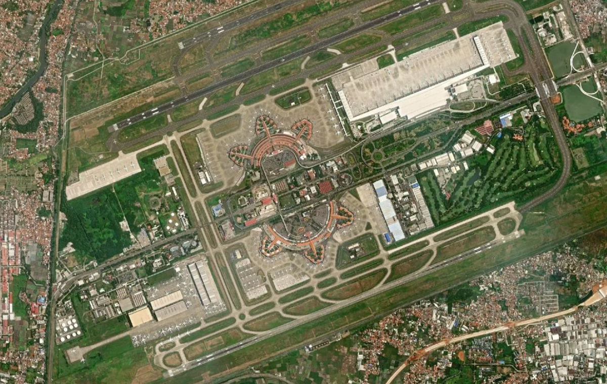
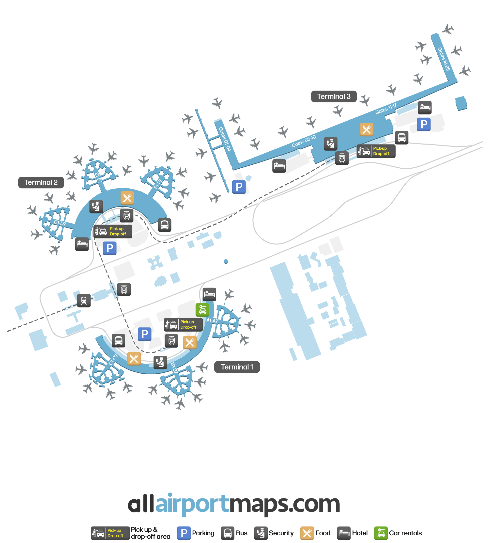
The airport consists of three terminals. These are connected thanks to the Skytrain, which also stops at the airport train station.

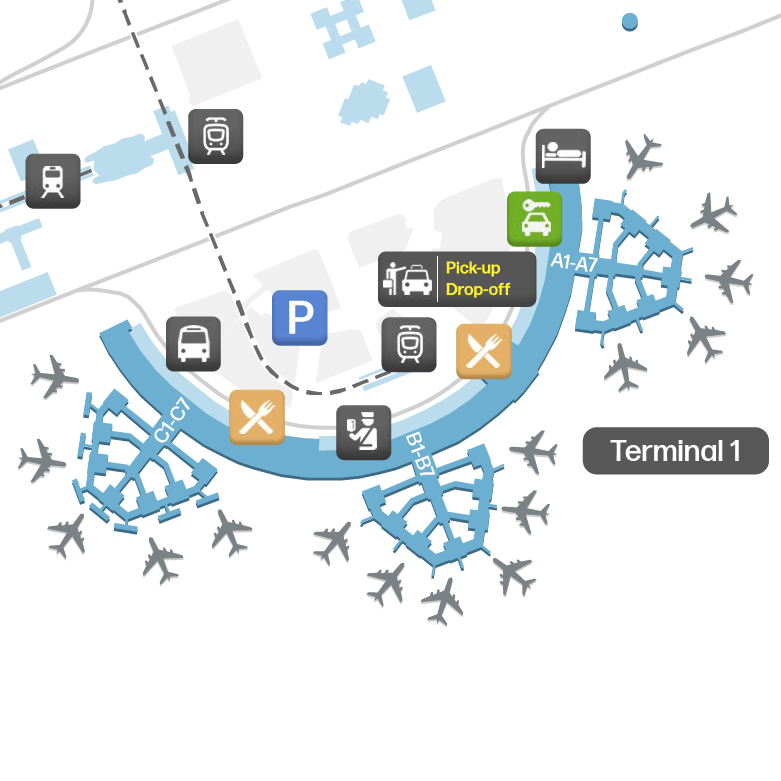
Terminal 1: This is the oldest terminal, and today, it serves domestic airlines.

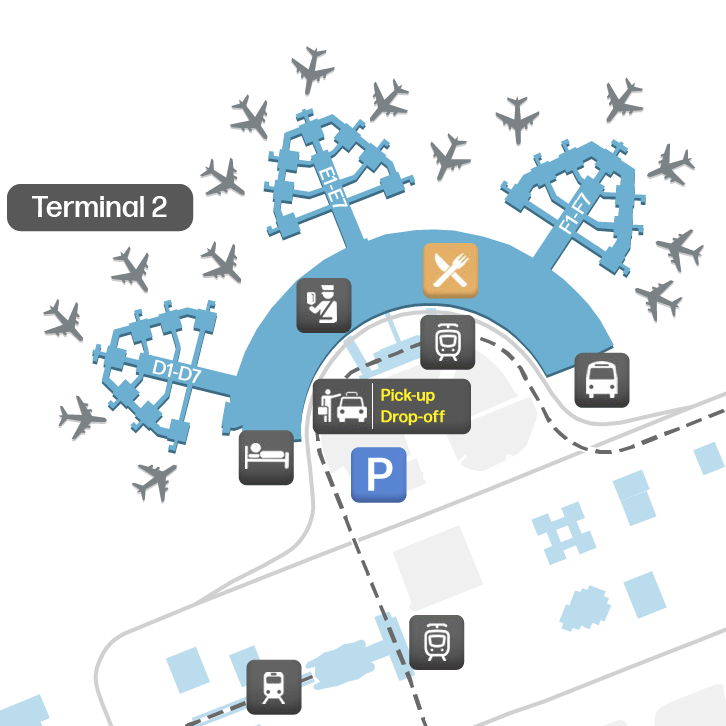
Terminal 2: Opened in 1991, Terminal 2 is opposite to Terminal 1 and is used for international and domestic flights.

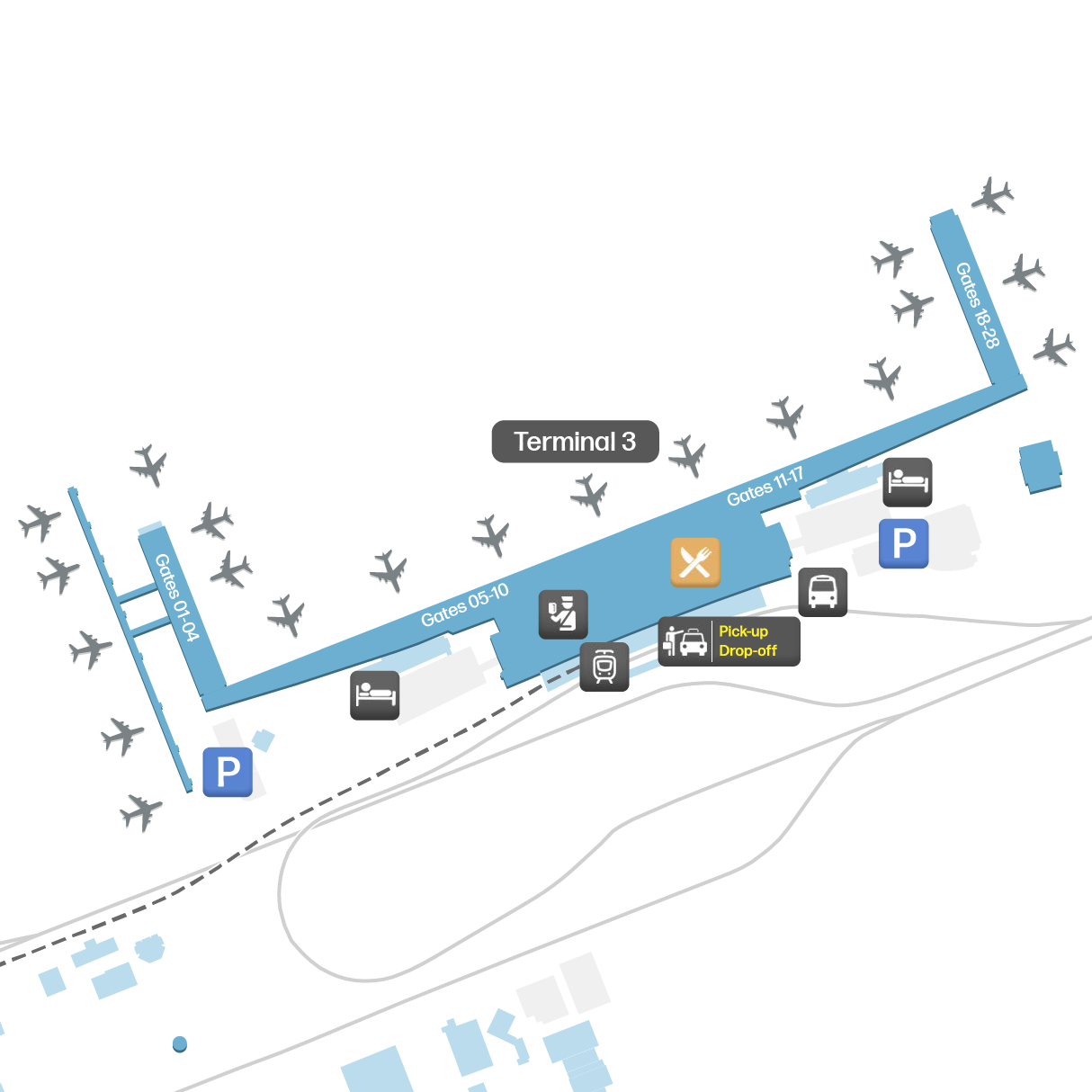
Terminal 3: This is the newest terminal and is used as a base for Garuda Indonesia, the flag carrier of Indonesia. Today, it operates both international and domestic flights.

Airport Time Information - CGK Current Time

CGK Airport Current Time
Asia/Jakarta
--:--
Your Local Time
Your Location
--:--

Soekarno Hatta International Airport Airport Information & Details

Airport IATA Code: CGK
Airport Location: Jakarta Airport, Indonesia
Coordinates: -6.130643, 106.655526
Timezone: Asia/Jakarta

CGK Terminal Maps & Floor Plans

Terminal 1 Map - CGK Layout

CGK Terminal 1 Map - Floor Plan & Gate Layout

Terminal 2 Map - CGK Layout

CGK Terminal 2 Map - Floor Plan & Gate Layout

Terminal 3 Map - CGK Layout

CGK Terminal 3 Map - Floor Plan & Gate Layout

Soekarno Hatta International Airport Satellite View & Aerial Map

Soekarno Hatta International Airport Airport Satellite View - CGK Aerial Map & Terminal Overview

Interactive Map - CGK Airport Location

External Maps - View CGK Airport on Google Maps & More