CNS Airport Map - Cairns International Airport Terminal Guide

Cairns Airport, Australia - Terminal Navigation Information

CNS Airport Terminal Map - Gates & Navigation

Cairns International Airport Airport Terminal Map - CNS Gates, Airlines & Navigation Guide

Cairns Airport: Terminal and gate map

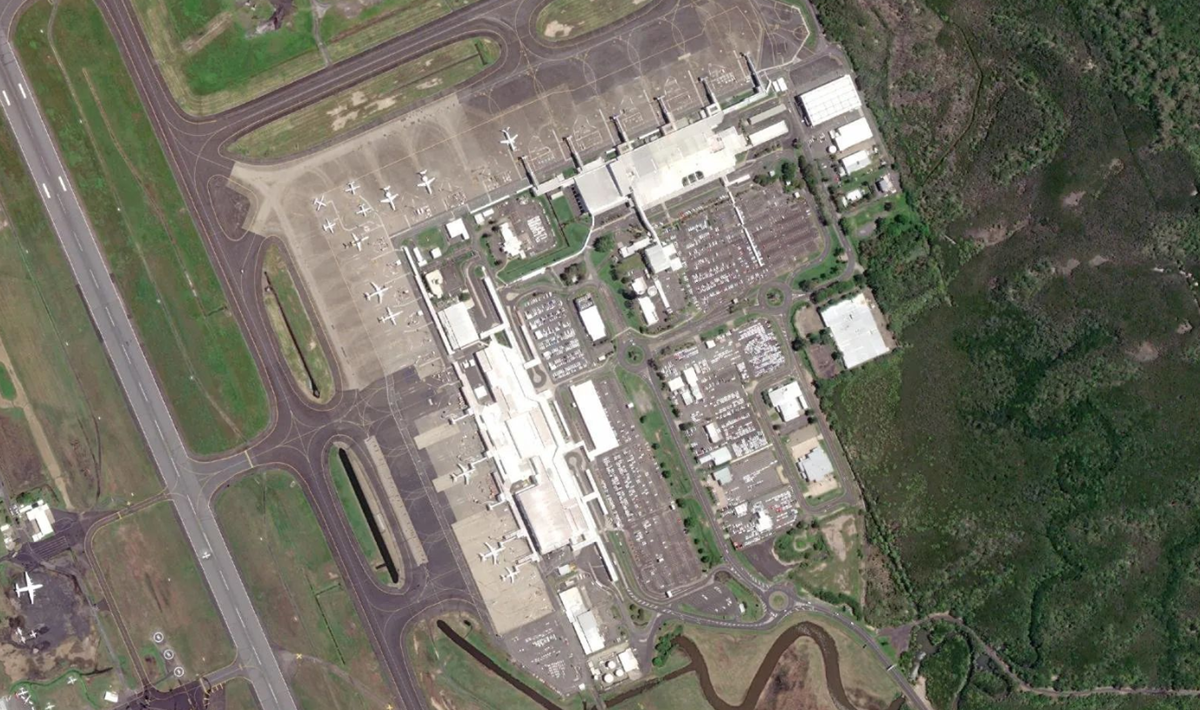
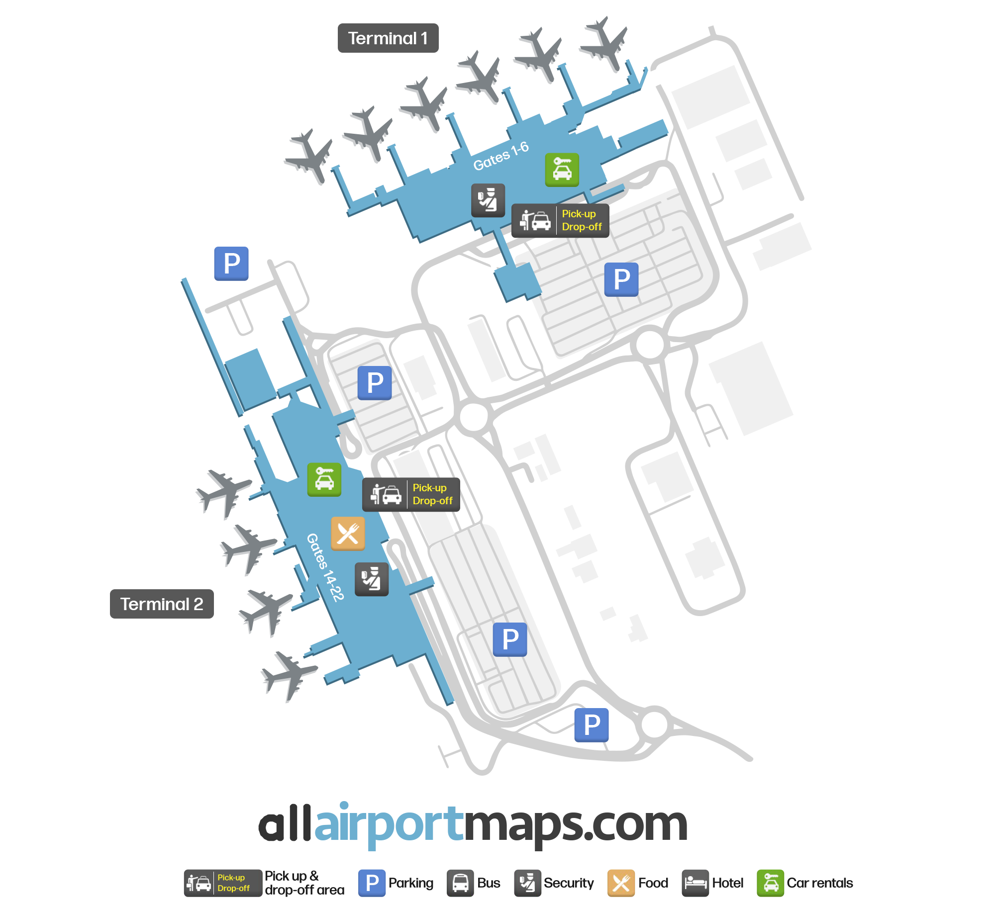
The airport consists of two passenger terminals, both of which are located to the east side of the airport grounds.

They are located in separate buildings from one another, only approximately 200 metres (660 ft) apart.

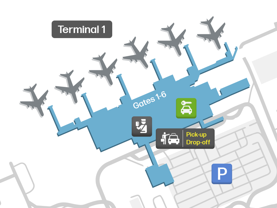
Terminal 1 is the international terminal. It contains six jet bridges and Gates 1-2, and 4-6.

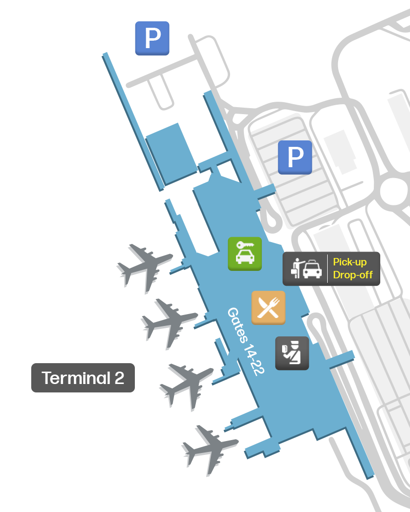
Terminal 2 is the domestic terminal. It contains five jet bridges and Gates 2, and 14-22.

Each terminal contains its own areas for check-in, security screening, departures and arrivals. They each also have their own stations where rental car companies operate their service counters.

You can view our map at the top of this page to see the terminals layout complete with the locations of their pickup and drop off areas, parking lots and ground transportation.

Airport Time Information - CNS Current Time

CNS Airport Current Time
Australia/Brisbane
--:--
Your Local Time
Your Location
--:--

Cairns International Airport Airport Information & Details

Airport IATA Code: CNS
Airport Location: Cairns Airport, Australia
Coordinates: -16.876538, 145.754041
Timezone: Australia/Brisbane

CNS Terminal Maps & Floor Plans

Terminal 1 Map - CNS Layout

CNS Terminal 1 Map - Floor Plan & Gate Layout

Terminal 2 Map - CNS Layout

CNS Terminal 2 Map - Floor Plan & Gate Layout

Terminal R Map - CNS Layout

CNS Terminal R Map - Floor Plan & Gate Layout

Cairns International Airport Satellite View & Aerial Map

Cairns International Airport Airport Satellite View - CNS Aerial Map & Terminal Overview

Interactive Map - CNS Airport Location

External Maps - View CNS Airport on Google Maps & More