LCY Airport Terminal Map - Gates & Navigation
London Airport, United Kingdom - Terminal Navigation Information
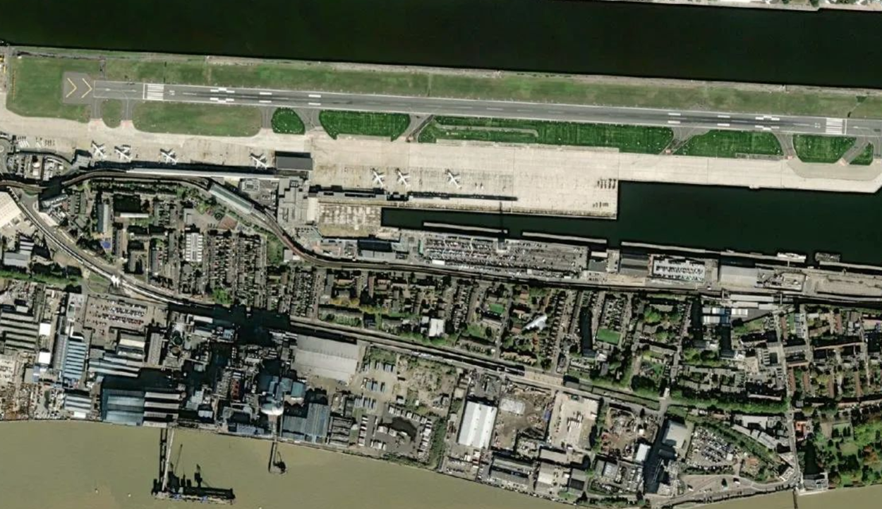
Given the limited space available in the local City area, the airport is relatively small compared to its larger competitors in Heathrow, Gatwick, Stansted and Luton.
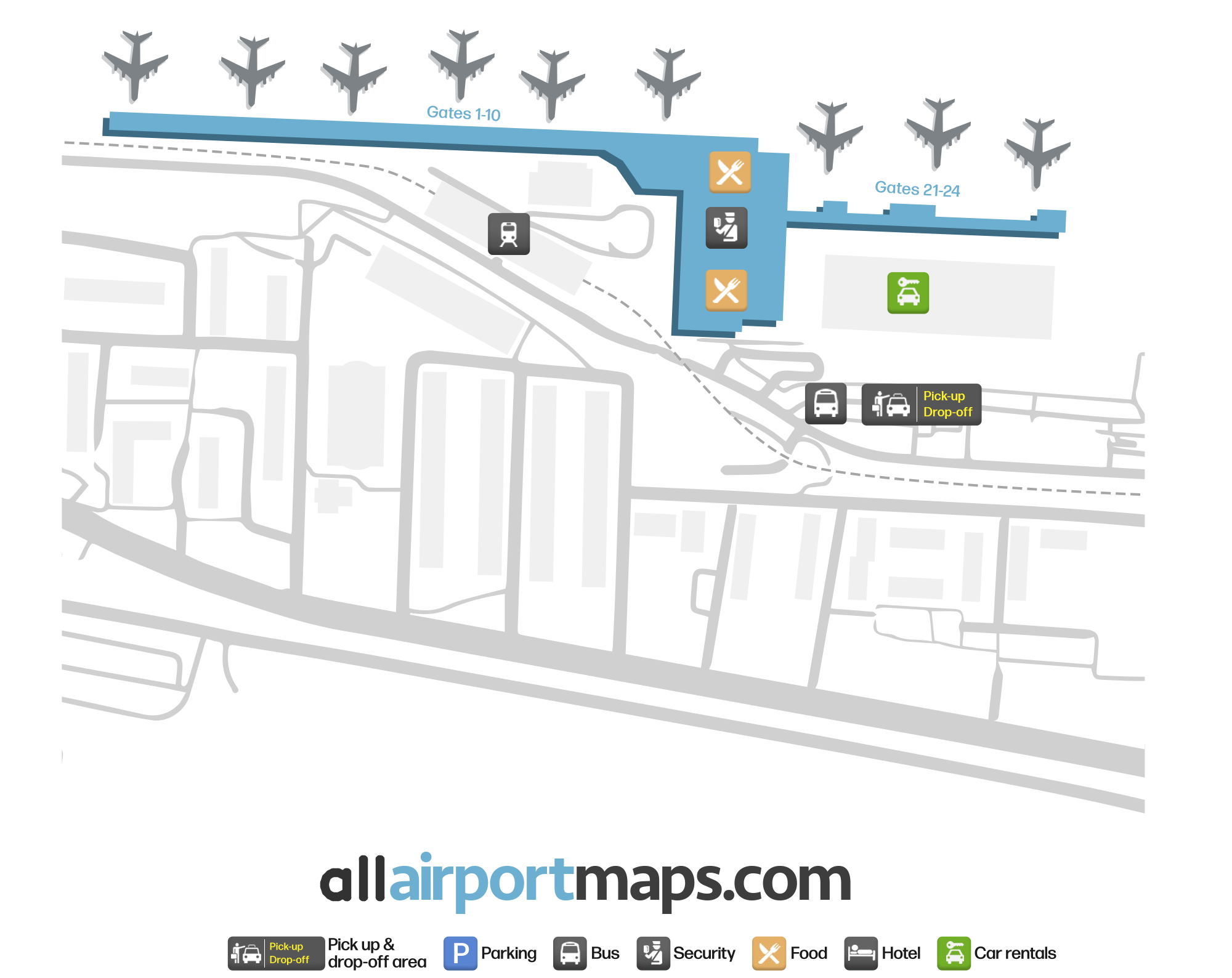
It consists of a single terminal, two-storey passenger building complete with 18 boarding gates, that are all hardstands.
The ground floor at the airport contains the check-in desks as well as some airport facilities. There is a staircase on the ground floor level that leads to a security checkpoint zone on the upper floor.
After clearing the security area, is the airside waiting area where travelers can gain access to several more shops and restaurants.
This waiting area is connected to piers on both sides. There are corridors on the upper floor that lead to departure gates on the ground level.
The gates are numbered sequentially at the airport, from left to right when facing the airside of the terminal. You can use our airport map at the top of this page to view the complete terminal layout which includes the location of the ground transportation services zone and rental car facility.