MEX Airport Map - Mexico City International Airport Terminal Guide

Mexico City Airport, Mexico - Terminal Navigation Information

MEX Airport Terminal Map - Gates & Navigation

Mexico City International Airport Airport Terminal Map - MEX Gates, Airlines & Navigation Guide

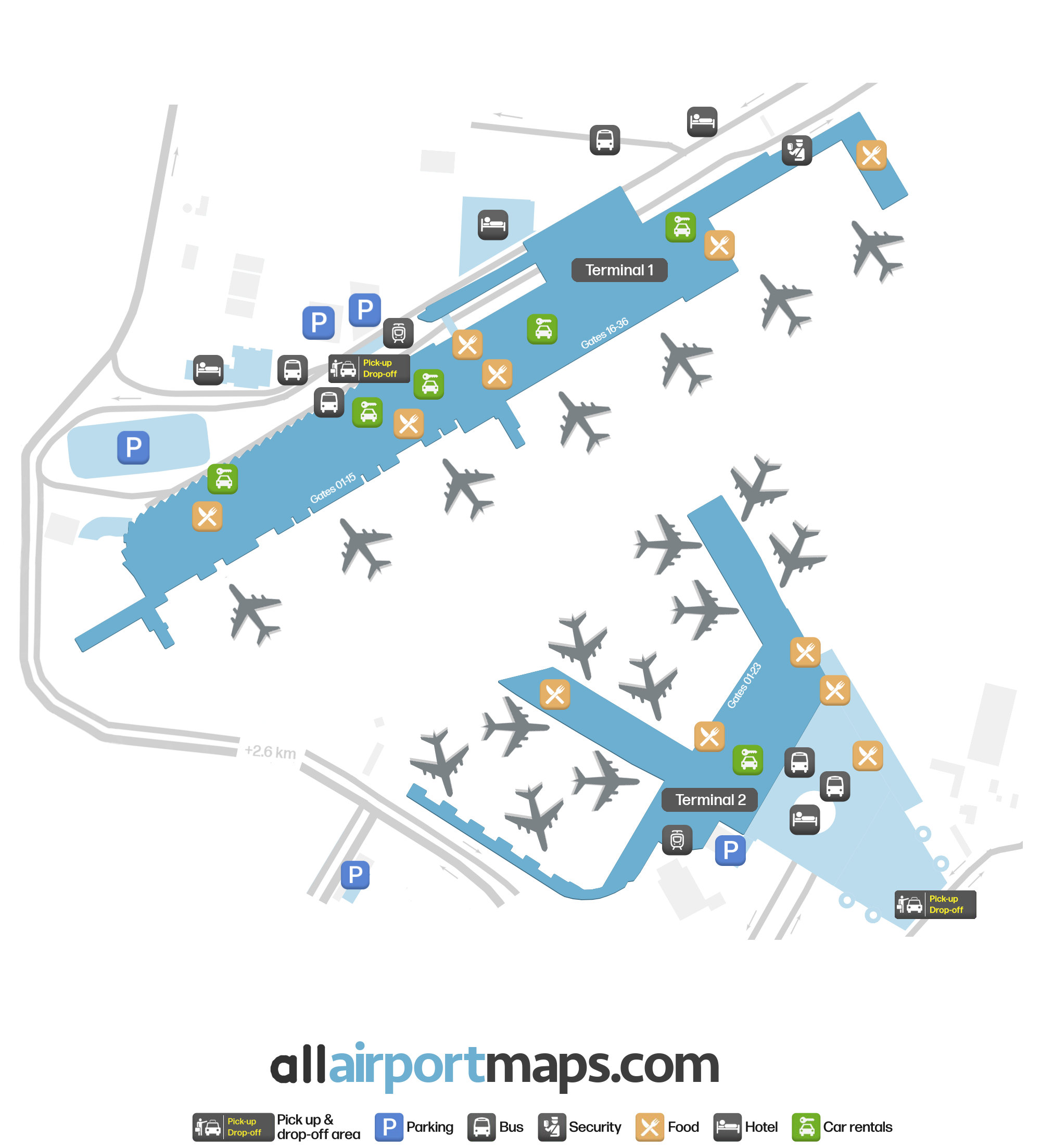
Benito Juárez International Airport Terminal and Gates Map

The airport is divided into two terminals connected by AirTrain. The train operates every day from 5:00 am to 11:00 pm and has a capacity of 100 people. It stops halfway across the 'Puente de Pilotos' Bridge in Terminal 1 and next to Domestic Departure, after room 'M' in Terminal 2.

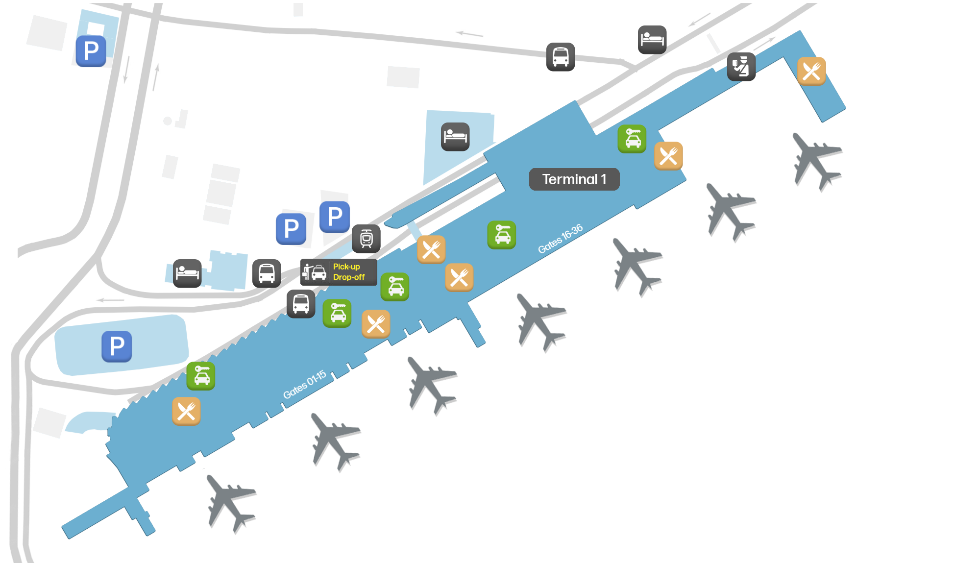
  • Terminal 1: This terminal serves both international and domestic flights and has two floors. The arrivals are located on the ground floor, while the first floor houses the departures, with gates 1-36.
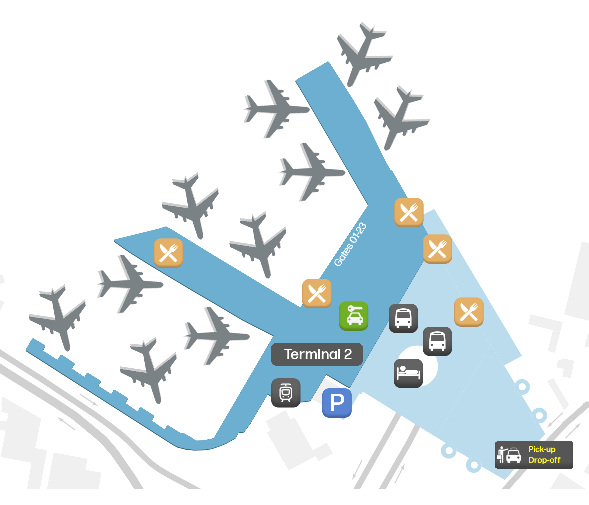
  • Terminal 2: Similarly to Terminal 1, Terminal 2 serves both Mexican and other destinations. International arrivals are located on the first floor close to the north pier, while domestic ones are next to the south pier. The first floor houses the departures with gates 52-75. This terminal also has a mezzanine level with a few restaurants, lounges, and airline offices.

Airport Time Information - MEX Current Time

MEX Airport Current Time
America/Mexico_City
--:--
Your Local Time
Your Location
--:--

Mexico City International Airport Airport Information & Details

Airport IATA Code: MEX
Airport Location: Mexico City Airport, Mexico
Coordinates: 19.435278, -99.072778
Timezone: America/Mexico_City

MEX Terminal Maps & Floor Plans

Terminal 1 Map - MEX Layout

MEX Terminal 1 Map - Floor Plan & Gate Layout

Terminal 2 Map - MEX Layout

MEX Terminal 2 Map - Floor Plan & Gate Layout

Mexico City International Airport Satellite View & Aerial Map

Mexico City International Airport Airport Satellite View - MEX Aerial Map & Terminal Overview

Interactive Map - MEX Airport Location

External Maps - View MEX Airport on Google Maps & More