MSP Airport Map - Minneapolis St Paul International Airport Terminal Guide

Minneapolis Airport, United States - Terminal Navigation Information

MSP Airport Terminal Map - Gates & Navigation

Minneapolis St Paul International Airport Airport Terminal Map - MSP Gates, Airlines & Navigation Guide

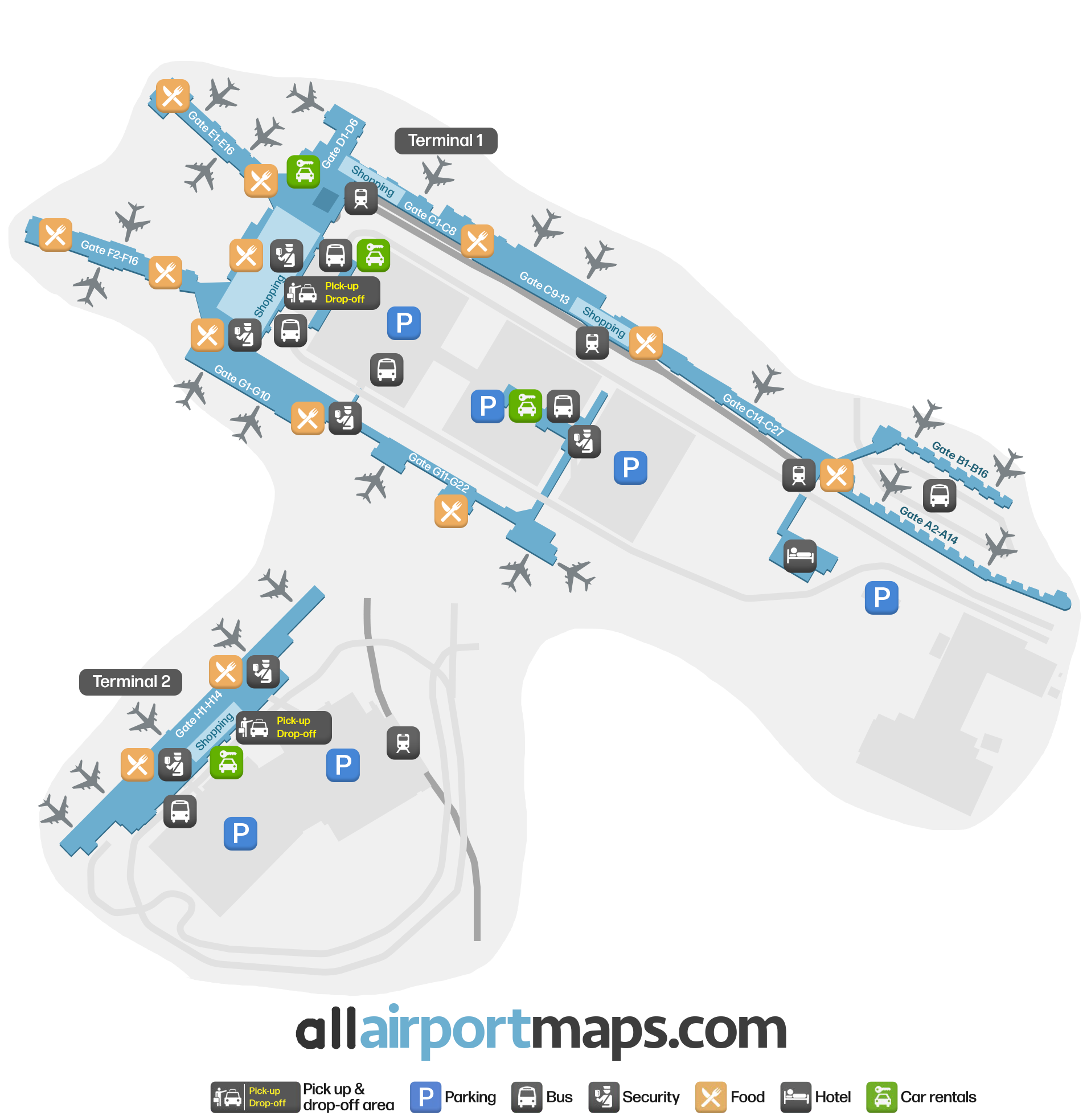
Navigating around MSP Airport – terminal map

As you can tell from the map at the top of the page, Minneapolis-Saint Paul International Airport is divided into two main terminals. Each terminal caters to different airlines and services, and in total there are more than 130 gates at the airport.

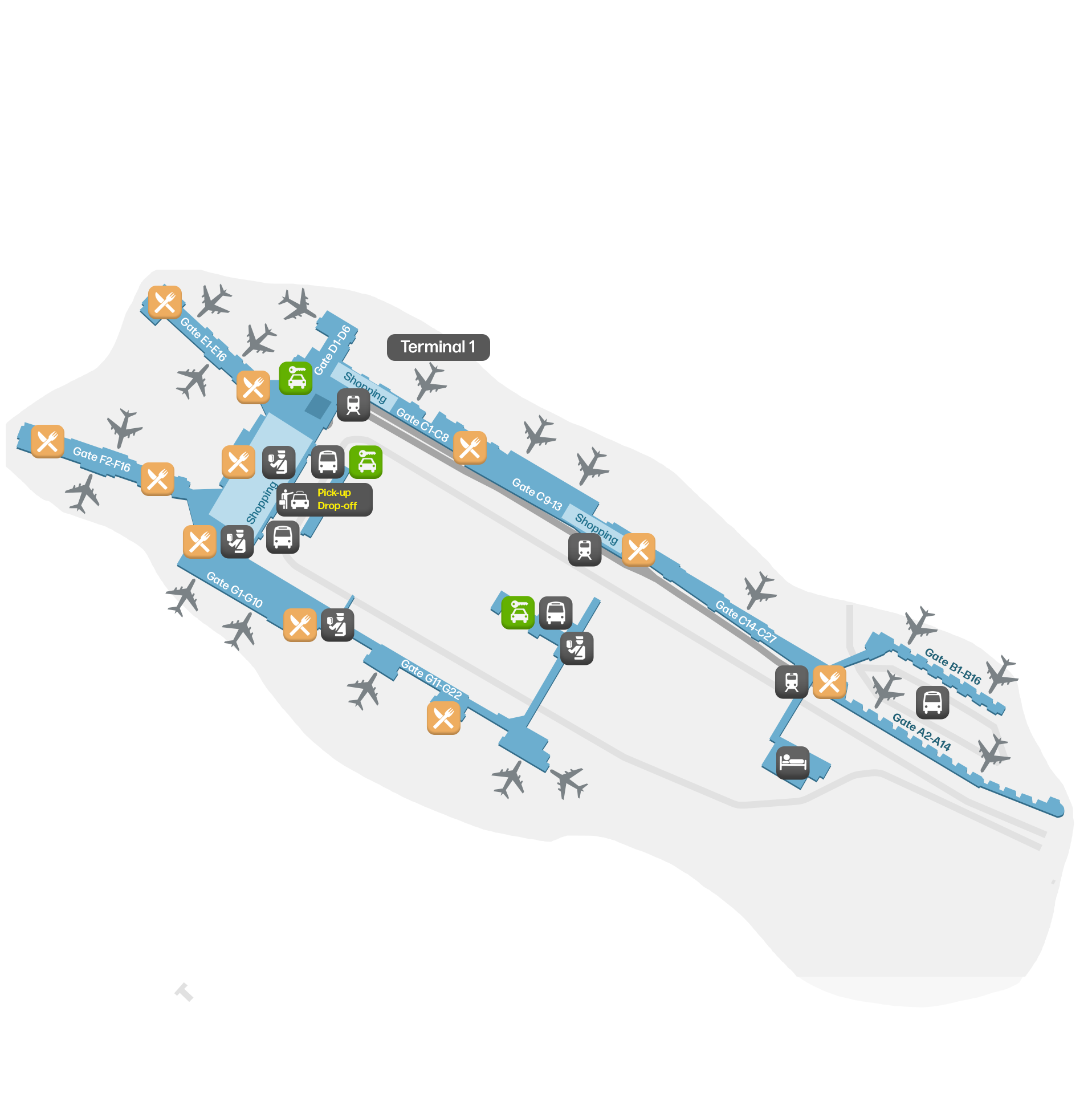
  • Terminal 1: This terminal is the largest and handles most of the airport’s domestic and international flights. It also features a wide array of amenities, including shopping, dining and security checkpoints. Some of the airlines operating out of Terminal 1 are American Airlines, Delta Air Lines and Air Canada.
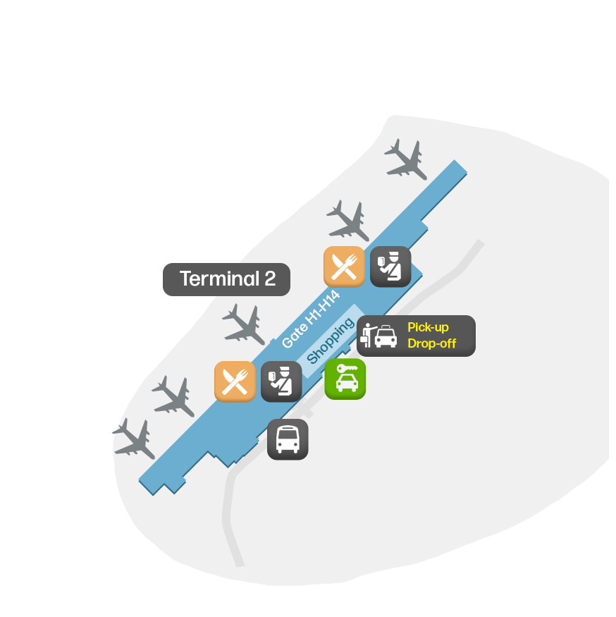
  • Terminal 2: Primarily serving low-cost carriers and some domestic flights, Terminal 2 provides flights with for example JetBlue and Southwest. You also find lots of options in terms of dining and shopping.

Airport Time Information - MSP Current Time

MSP Airport Current Time
America/Chicago
--:--
Your Local Time
Your Location
--:--

Minneapolis St Paul International Airport Airport Information & Details

Airport IATA Code: MSP
Airport Location: Minneapolis Airport, United States
Coordinates: 44.883016, -93.210922
Timezone: America/Chicago

MSP Terminal Maps & Floor Plans

Terminal 1 Map - MSP Layout

MSP Terminal 1 Map - Floor Plan & Gate Layout

Terminal 2 Map - MSP Layout

MSP Terminal 2 Map - Floor Plan & Gate Layout

Minneapolis St Paul International Airport Satellite View & Aerial Map

Minneapolis St Paul International Airport Airport Satellite View - MSP Aerial Map & Terminal Overview

Interactive Map - MSP Airport Location

External Maps - View MSP Airport on Google Maps & More