NCL Airport Map - Newcastle International Airport Terminal Guide

Newcastle Airport, United Kingdom - Terminal Navigation Information

NCL Airport Terminal Map - Gates & Navigation

Newcastle International Airport Airport Terminal Map - NCL Gates, Airlines & Navigation Guide

Newcastle Airport: Terminal and gate map

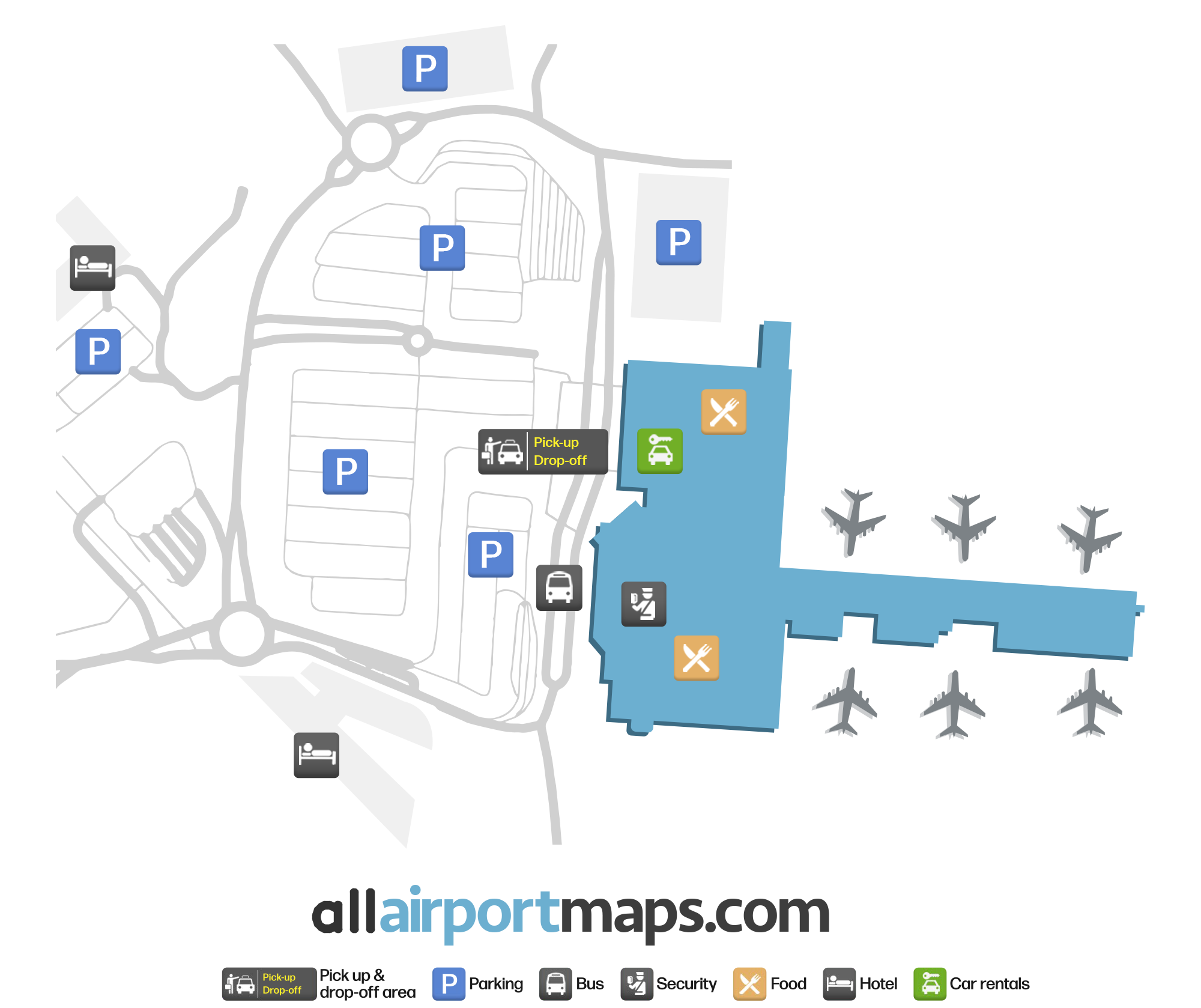
The airport consists of a single terminal. It has one drop-off area for passengers arriving at the airport. After clearing the security checkpoint, there are several shops and restaurants.

Beyond the main hall, there is a pier containing several gates. There are multiple gates available for domestic and international flights.

Using our map at the top of this page, you can view the terminal layout and the location of its gates, along with the pick-up and drop-off areas, and security checkpoint.

Airport Time Information - NCL Current Time

NCL Airport Current Time
Europe/London
--:--
Your Local Time
Your Location
--:--

Newcastle International Airport Airport Information & Details

Airport IATA Code: NCL
Airport Location: Newcastle Airport, United Kingdom
Coordinates: 55.037062, -1.710629
Timezone: Europe/London

Newcastle International Airport Satellite View & Aerial Map

Newcastle International Airport Airport Satellite View - NCL Aerial Map & Terminal Overview

Interactive Map - NCL Airport Location

External Maps - View NCL Airport on Google Maps & More