PHX Airport Map - Phoenix Sky Harbor International Airport Terminal Guide

Phoenix Airport, United States - Terminal Navigation Information

PHX Airport Terminal Map - Gates & Navigation

Phoenix Sky Harbor International Airport Airport Terminal Map - PHX Gates, Airlines & Navigation Guide

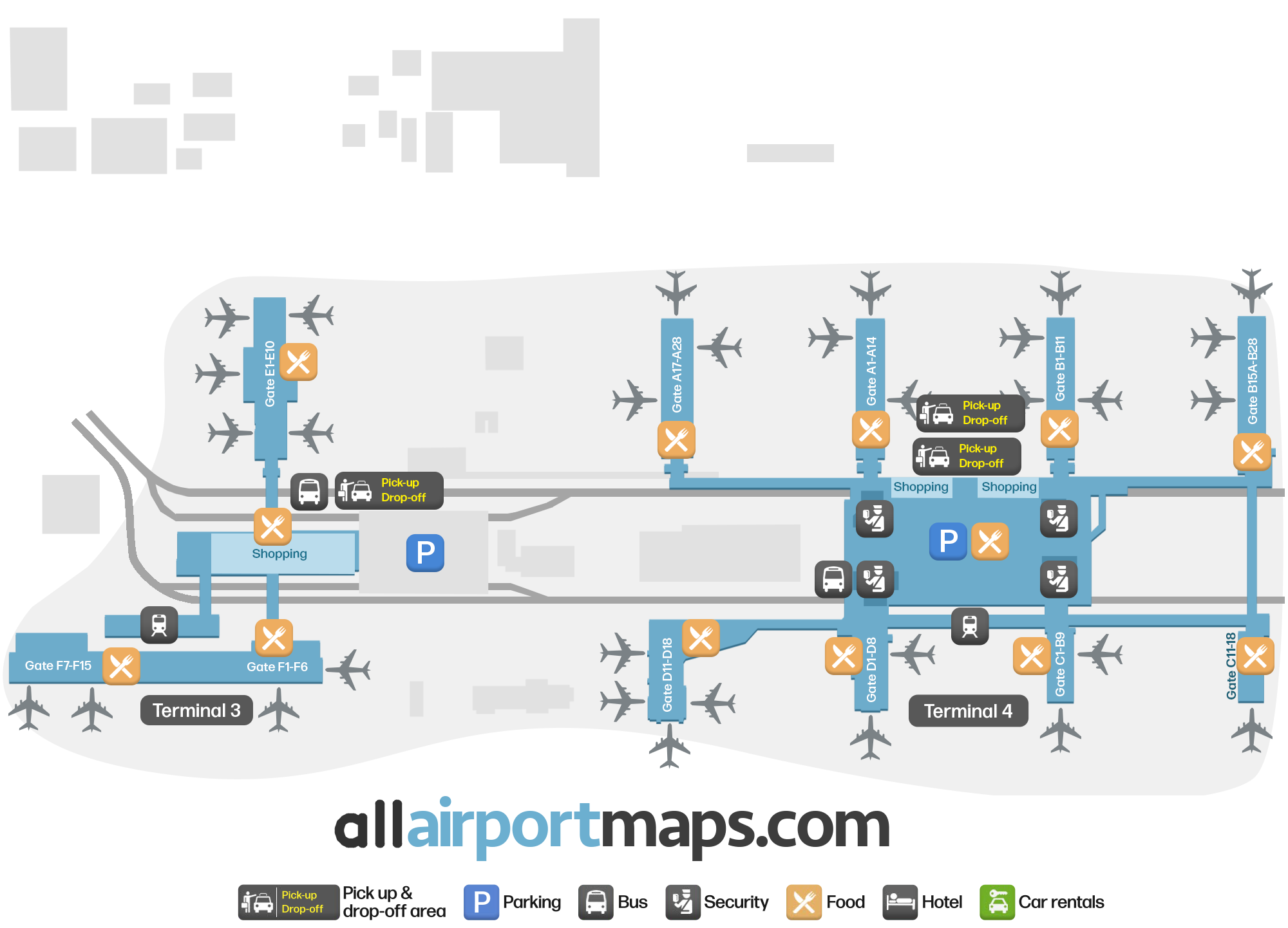
Gate map – find your way at the airport

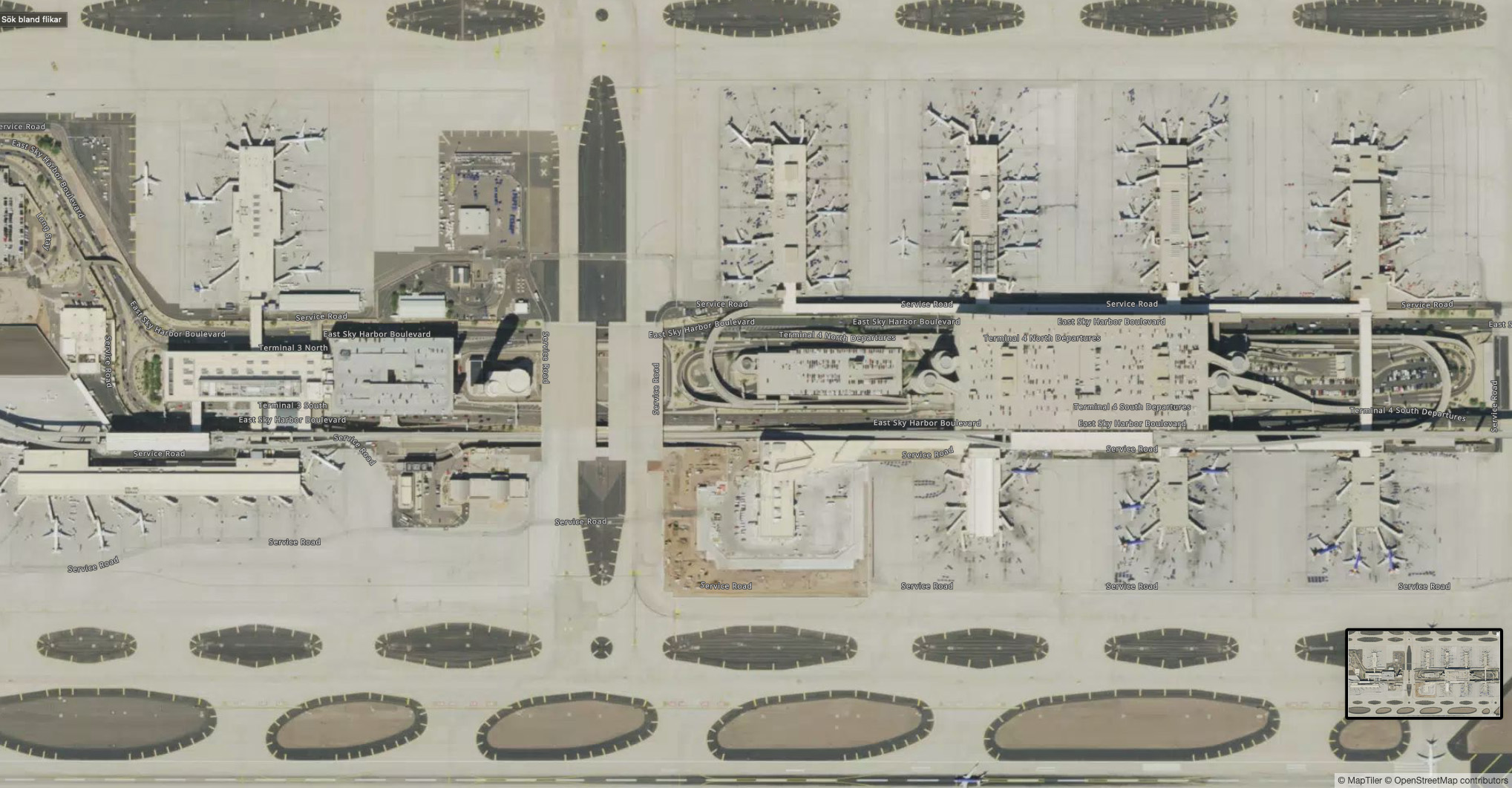
Sky Harbor Airport is divided into two terminals that are called Terminal 3 and Terminal 4. Below you find some information about each terminal, and if you want to find the location of any terminal or gate we recommend that you have a look at the map on the top of the page.

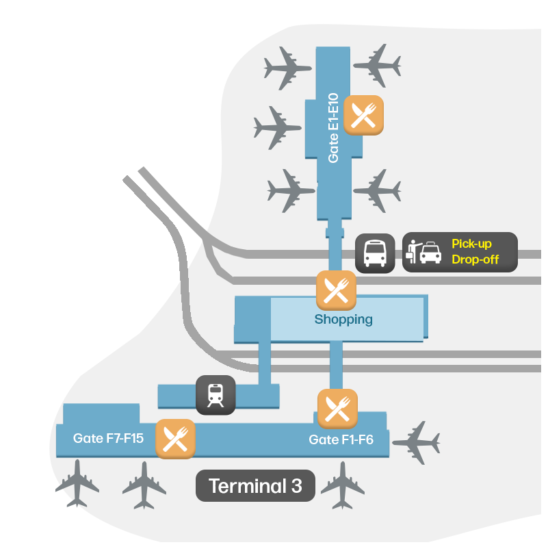
  • Terminal 3: This terminal is used by operators such as Delta Air Lines, Frontier Airlines and Hawaiian Airlines, and serves for both domestic and international flights. The gates in Terminal 3 are numbered from E1 to E10 and F1 to F9.
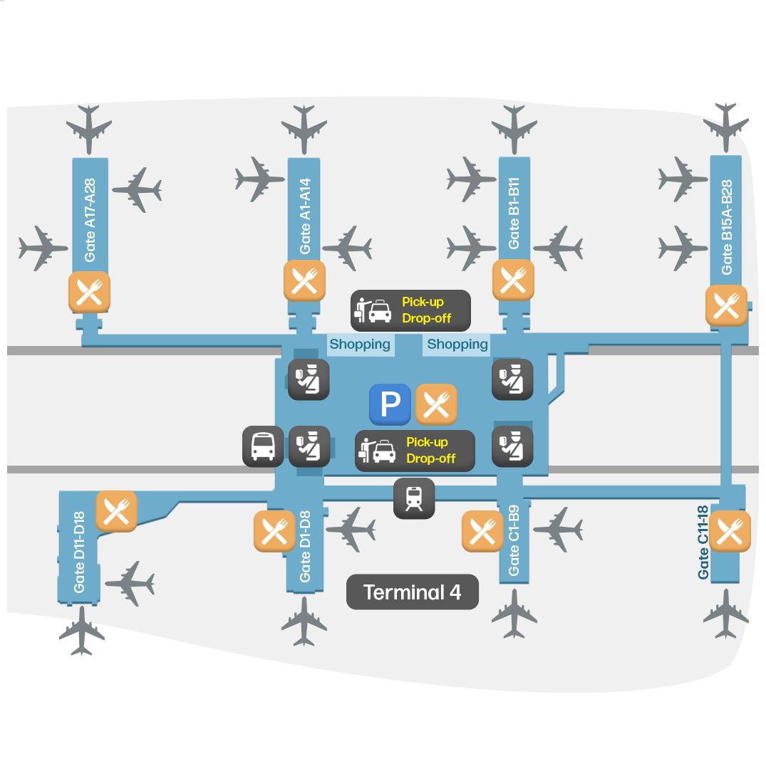
  • Terminal 4: This is the largest terminal at Phoenix Sky Harbor International Airport and is used by American Airlines and Southwest Airlines. It handles a mix of domestic and international flights and the gates are divided into four concourses: A (A1 to A30), B (B1 to B28), C (C1 to C19) and D (D1 to D8).

Airport Time Information - PHX Current Time

PHX Airport Current Time
America/Phoenix
--:--
Your Local Time
Your Location
--:--

Phoenix Sky Harbor International Airport Airport Information & Details

Airport IATA Code: PHX
Airport Location: Phoenix Airport, United States
Coordinates: 33.435036, -112.000164
Timezone: America/Phoenix

PHX Terminal Maps & Floor Plans

Terminal 3 Map - PHX Layout

PHX Terminal 3 Map - Floor Plan & Gate Layout

Terminal 4 Map - PHX Layout

PHX Terminal 4 Map - Floor Plan & Gate Layout

Phoenix Sky Harbor International Airport Satellite View & Aerial Map

Phoenix Sky Harbor International Airport Airport Satellite View - PHX Aerial Map & Terminal Overview

Interactive Map - PHX Airport Location

External Maps - View PHX Airport on Google Maps & More