RNO Airport Map - Reno Tahoe International Airport Terminal Guide

Reno Airport, United States - Terminal Navigation Information

RNO Airport Terminal Map - Gates & Navigation

Reno Tahoe International Airport Airport Terminal Map - RNO Gates, Airlines & Navigation Guide

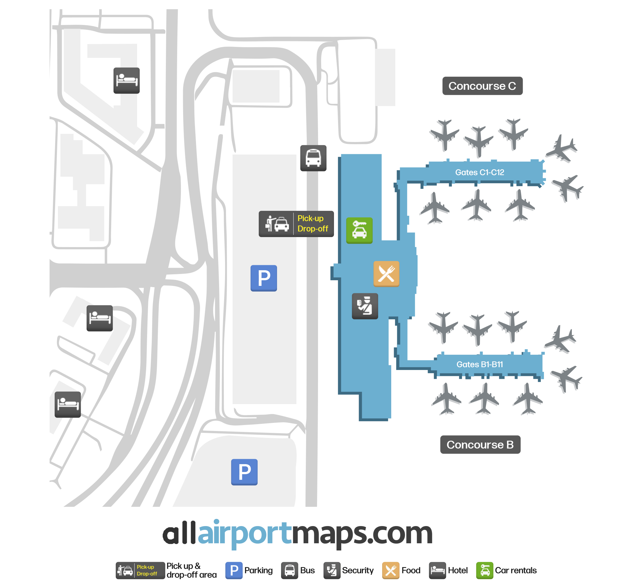
Reno Tahoe International Airport Terminal and Gates Map

RNO consists of a single terminal building divided into two floors:

  • First Floor: Travelers can access the building from its west side. Car rental agencies and baggage claims are on the left, while check-in desks are on the right. If heading straight, passengers will quickly reach VTA checkpoints.
  • Second Floor: This floor is home to a High Mountain Marketplace area featuring a variety of eateries and stores. Concourse B, with Gates B1-B11, is located on its right, while Concourse C, with Gates C1-C12, is on the left. The former is used by Delta, JetBlue, Southwest, and Spirit, while the latter is used by Alaska, American, Sun Country, United, and Volaris.

Airport Time Information - RNO Current Time

RNO Airport Current Time
America/Los_Angeles
--:--
Your Local Time
Your Location
--:--

Reno Tahoe International Airport Airport Information & Details

Airport IATA Code: RNO
Airport Location: Reno Airport, United States
Coordinates: 39.505782, -119.775698
Timezone: America/Los_Angeles

Reno Tahoe International Airport Satellite View & Aerial Map

Reno Tahoe International Airport Airport Satellite View - RNO Aerial Map & Terminal Overview

Interactive Map - RNO Airport Location

External Maps - View RNO Airport on Google Maps & More